Coleman Connected

Click here to visit the forum

Weather

Coleman Connected News > Weather

System error: -2147012889.
The download of the specified resource has failed.
Current Radar - Click image to enlarge


For best viewing:Choose radar, then click down arrow on top right


Ice storm on the Ranch. Coleman, Texas 2007

Sunday, January 28, 2018 - Posted by Craig, in General News., City news, Coleman scenery & photos, Videos, Weather


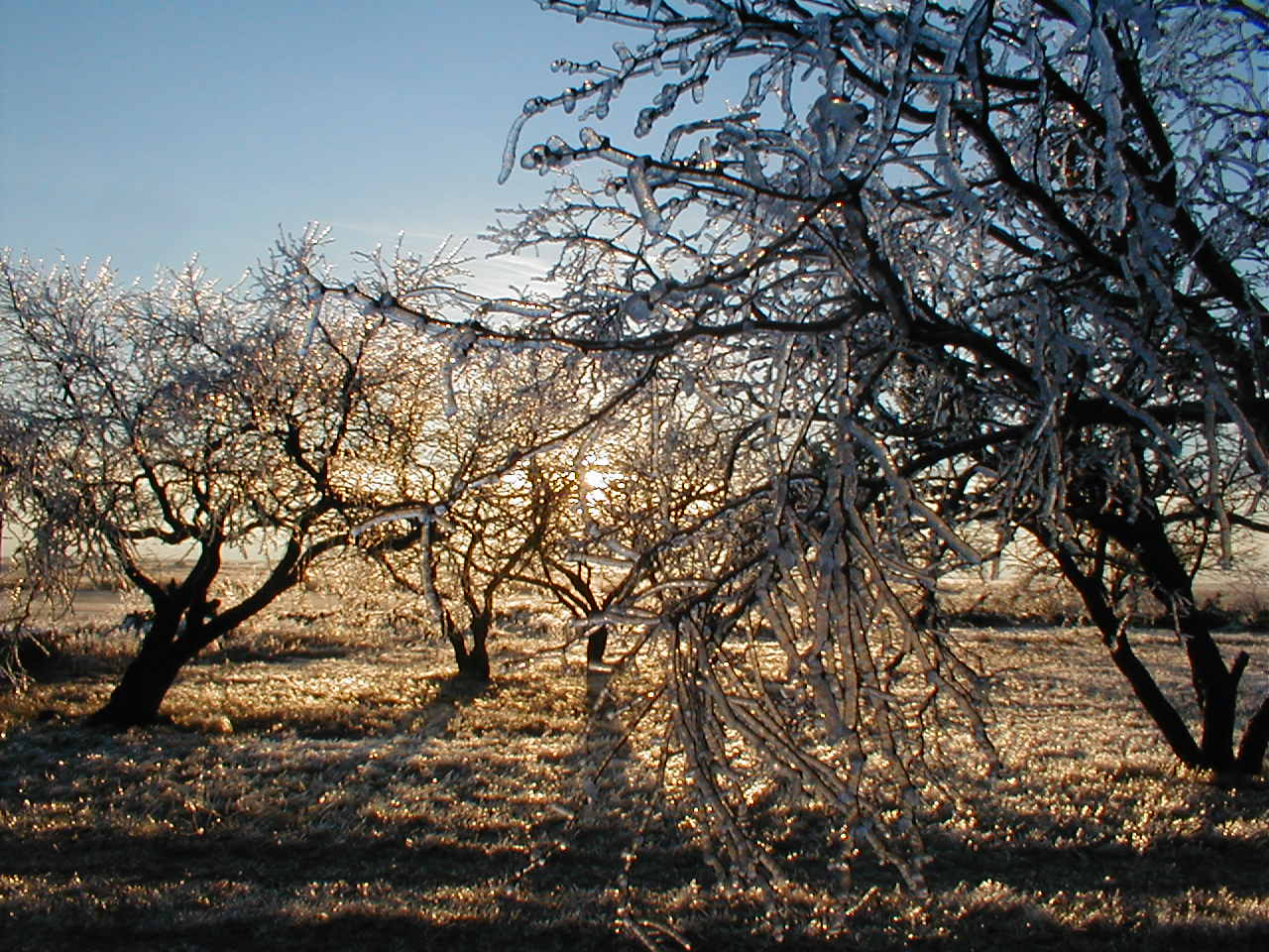
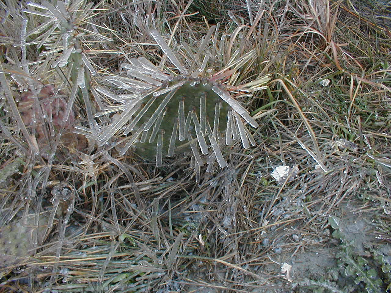
January of 2007 brought to Coleman, Texas the perfect set of super cold lower air and heavy rain. Ice formed instantly as it hit the surface.

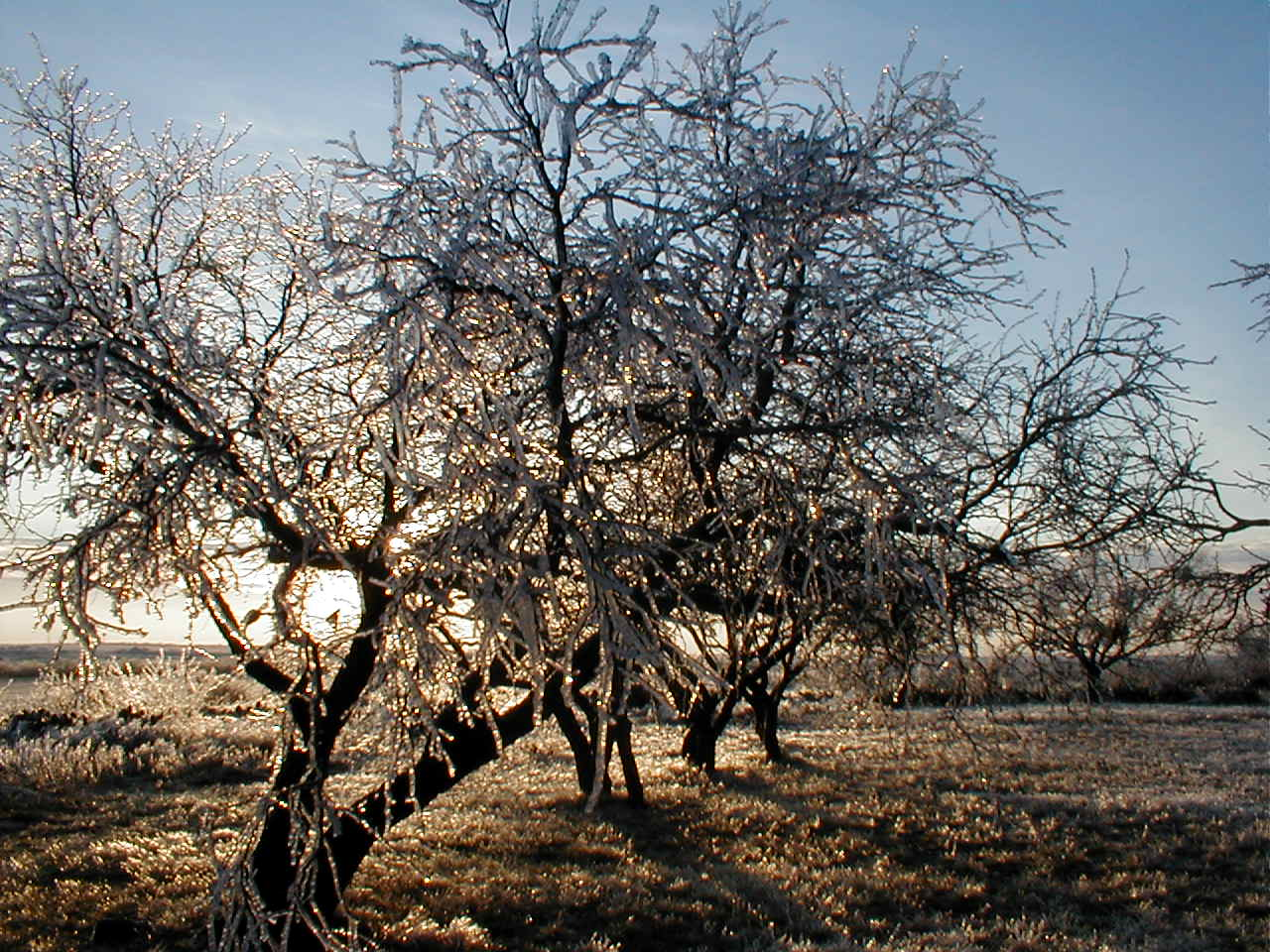
Every twig grew 5 times its size with ice.


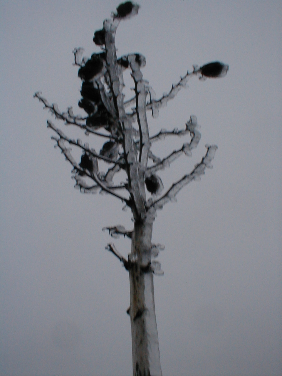
What is left of a yucca tree.


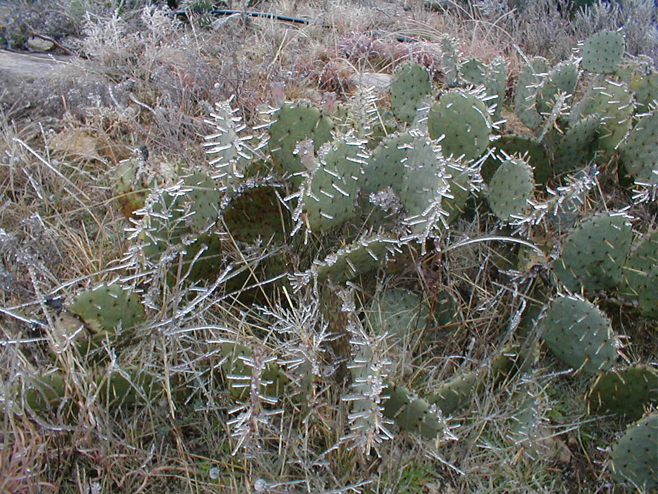
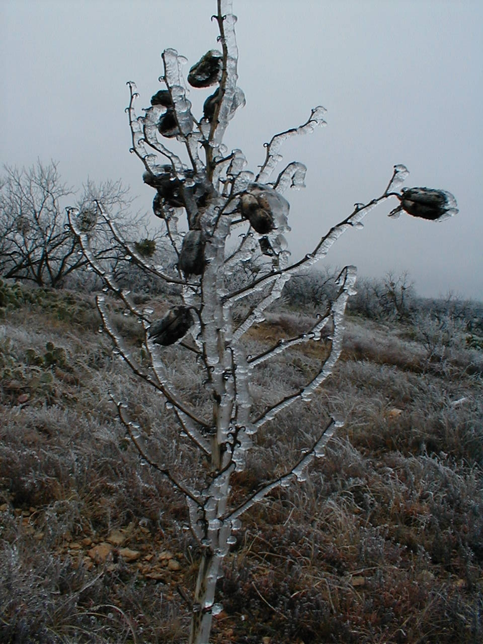
The infamous prickly pear.

Coleman, Texas is a quiet little town (5,000) located about 150 miles south west of Forth Worth and 55 miles south east of Abilene. Any further west and the world of green fades to brown as every living thing struggles for a drop of water. Coleman is wonderfully green in the spring and fall with weather that changes daily making it nearly impossible to know what to wear and when to plan, but we love it and call it home.

Wildlife is as diverse as the weather. If your driving through Texas on your way to get away from it all, stop on by, you will be pleasantly surprised!

I'll post some pictures of the quaint downtown as soon as I can get a chance.

Many blessings.

https://ColemanAir.us

Craig

View Comments 0 Comments
Share Post   


1.00 inch hail near Coleman,TX

Wednesday, April 22, 2015, in Weather


04/22/2015 Hail Storm Report

This quarter sized hail was reported on 04/22/2015 near Coleman, Texas. Coleman has a population of 4709. The exact location coordinates of the hail report were 31.8, -99.43. This area has had 23 hail storm reports within 10 miles.

To research all hail storm reports near Coleman, click here.

Hail Report Summary

Hail Size Nearest City Location County State
1.00 inch Coleman 2 S Coleman Coleman Texas
Coordinates Population Nearby Hail ZipCode Time
31.8, -99.43 4709 23 Reports 76834 3:18 PM, CDT
Remarks/(Station):
(SJT)

Hail Report Map


View Comments 0 Comments
Share Post   


Coleman spared from violent weather

Sunday, April 19, 2015 - Posted by Craig Allen, in General News., Weather

We buttoned up the ranch this last Thursday in preparation for the significant weather that was forecast to hit Coleman county through Saturday; yet here at the ranch, and for most of us in Coleman, we only saw a little rain. Each day a new threat of significant weather, and every day, the storms just seemed to split just as they approached Coleman. 

When we first moved here, I often thought we moved just 8 miles to far west, as it would appear that the grass was just a little greener as we drove towards Brownwood.  Perhaps now; years later, I've come to appreciate the fact that Coleman really could use a LOT more rain, but, we really do not need every weather event to materialize for us. 

Sometimes we really need to appreciate what we have and have received as well as what we have not.


A tornado touched down [last week] in McHenry, Illinois.  Tornadoes hit multiple locations.

Here is some incredible footage of a tornado tipping a truck over and debris flying everywhere. This footage is near Rochelle, Illinois.  Note: This video is public. The "not for broadcast statement" is not pertinent to youtube embedded shares.


View Comments 0 Comments
Share Post   


Weather Alert for Coleman

Friday, April 17, 2015 - Posted by Administrator, in Weather

The NWS Storm Prediction Center has issued a

* Severe Thunderstorm Watch for portions of 
  western-north and central Texas

* effective this Friday morning and evening from 1150 am until
  700 PM CDT.

* Primary threats include...
  scattered large hail likely with isolated very large hail events
    to 2 inches in diameter possible
  scattered damaging wind gusts to 70 mph likely
  a tornado or two possible

Summary...thunderstorms over western and central TX will track
eastward across the watch area this afternoon and early
evening...capable of large hail and damaging winds.

The Severe Thunderstorm Watch area is approximately along and 85
statute miles east and west of a line from 35 miles southwest of
Cotulla Texas to 90 miles north northwest of Mineral Wells Texas.
 For a complete depiction of the watch see the associated watch
outline update (wous64 kwns wou7).

Precautionary/preparedness actions...

Remember...a Severe Thunderstorm Watch means conditions are
favorable for severe thunderstorms in and close to the watch
area. Persons in these areas should be on the lookout for
threatening weather conditions and listen for later statements
and possible warnings. Severe thunderstorms can and occasionally
do produce tornadoes.


Aviation...a few severe thunderstorms with hail surface and aloft
to 2 inches. Extreme turbulence and surface wind gusts to 60
knots. A few cumulonimbi with maximum tops to 500. Mean storm
motion vector 25025.


...Hart


View Comments 0 Comments
Share Post   


Forum